Cornwall Beache Guide

Posted by Select Cornwall

on 05/02/2026

South East Cornwall Beaches (Part 8) | Select Cornwall

South East Cornwall Beaches (Part 8)

Pinch-zoom map • icon filters • mobile-first

There are a LOT of beaches in Cornwall…

This final South East Cornwall stretch packs in everything: rockpooling coves, wide open sand at low tide, calm village bays, and dramatic cliff paths. Use the filters to narrow down the best match, then pinch-zoom the map and tap a pin to jump straight in.

Filter beaches (tap to toggle)

Filters hide beach cards and map pins at the same time.

Showing 7 beaches
Note: Tags power the whole system. Each beach card has data-tags, and each map pin uses the same tags. That’s why we “need IDs for map pins” — the pin links to #beach-id.

Map of beaches in this section

Tip: pinch to zoom • tap a pin for quick links
Pins may look crowded until you zoom in (made for mobile).

Downderry Beach

Mostly shingle Sand ribbons at low tide Rock pools
Back to map

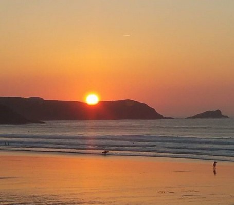
Downderry is the kind of beach that quietly surprises people. It’s long enough to spread out even on busy days, and when the tide drops it reveals ribbons of sand between the stones, plus a seemingly endless supply of rock pools to explore. On calm days the water can be clear enough for an easy snorkel close to shore, and after a south-westerly you’ll often see small, surfable waves rolling in. A slipway also makes it useful for launching small craft when the sea state allows.

Wander east of the larger rock outcrops and it starts to feel wilder and more remote, with cliff nooks and little caves. You’re still close to village essentials though, including sea-view stops for food and the classic “ice cream after the beach” finish.

Nearest town

Saltash (area)

Lifeguards

No lifeguard cover

Best for

Rock pools • snorkel • space to spread out

Safety: currents and sea state can change quickly—check tides, observe conditions, and swim cautiously.

Kingsand Beach

Village bay Sand & shingle Dogs all year
Back to map

Kingsand Beach sits right at the heart of a characterful fishing village on the Rame Peninsula. It’s a compact south-east facing bay that often feels sheltered, with cottages and the waterfront so close you can wander from the sand straight into the village. The iconic clocktower is the natural meeting point, and the view across Plymouth Sound adds a constant backdrop of boats and passing ships.

At lower tides you’ll find rock pools around the edges, making it popular with families who like a gentle explore. With cafés, pubs and village essentials close by, Kingsand is perfect for a “swim + lunch” day, or as a relaxed stop on a coastal wander to neighbouring Cawsand.

Type

Sand & shingle

Lifeguards

No lifeguard cover

Dogs

Allowed all year

Lantic Bay

Hidden-gem cove Steep access Watch the tide
Back to map

Lantic Bay is one of those places people describe as a “hidden gem” for a reason: it takes effort to reach, but the reward is a spectacular view of pale sand and turquoise water backed by high, green cliffs. It sits on the quiet stretch of coast between Fowey and Polperro, and on the right day it can look almost tropical.

There are two coves here—Little Lantic and Great Lantic—often connected on lower tides, with extra nooks further along the western side. It’s vital to keep an eye on the sea as the tide turns, because access between coves can be cut off. With no lifeguards and the potential for rip currents, treat conditions with respect. Pack what you need: there are no amenities on the beach itself.

Facilities

None on the beach

Access

Walk + steep cliff path

Best for

Scenery • photography • calm-day swims

Tip: decide your “turn back time” before you explore between coves.

Polperro Beach

Harbour-side Can vanish at high tide Toilets nearby
Back to map

Polperro is famous for its postcard harbour, and the beach is a small, sheltered strip positioned just outside the harbour walls. It sits under the cliffs by the entrance, so it often feels calmer than the open coast. The trade-off is size: this is a “quick paddle after exploring the village” beach rather than a wide sandy sprawl.

Tide timing matters here. At certain states of tide the sand shrinks dramatically—and at high tide it can disappear—so it’s worth checking tide times before you set off. Polperro’s real magic is the combination: winding lanes, whitewashed cottages, harbour views, then a brief beach stop to finish. Parking is typically up the valley, with a walk (or shuttle) down to the harbour area.

Lifeguards

No lifeguard cover

Dogs

Seasonal restrictions (check signage)

Best for

Village visit • sheltered splash • harbour photos

Portwrinkle Beach (Finnygook & Hoodny Cove)

Two coves Rock pools Café + toilets
Back to map

Portwrinkle sits in Cornwall’s “forgotten corner” and still feels like a working village rather than a resort. You’ve effectively got two beaches here: Finnygook (the main stretch) and Hoodny Cove (more tucked-away), plus a small patch of sand inside the harbour. Finnygook has fine sand down to mid-tide where a rocky ledge creates loads of rock pools—great for kids—and it can become a pleasant snorkel spot as the tide pushes in.

Hoodny Cove feels more sheltered under green cliffs, with the same mix of sand and rocky foreshore but a quieter vibe. Access is fairly straightforward via the harbour path, and with basic facilities nearby it’s a strong choice for a calmer beach day away from the bigger hotspots.

Also known as

Finnygook & Hoodny

Facilities

Café + toilets nearby

Best for

Rock pools • snorkel • quieter village feel

Seaton Beach

Level access Dogs all year Café • shop • toilets
Back to map

Seaton is a friendly, practical beach at the foot of the wooded Hessenford valley, where the River Seaton meanders across the shore. That river channel becomes the star attraction for families—children can paddle and play a little more sheltered from the open sea, and it adds a peaceful “nature corridor” feel to the day.

The beach is a mix of grey pebbles and coarser sand, with flat rock edges that reveal rock pools as the tide drops. In calmer conditions, swimming is generally comfortable, and the promenade makes it easy to stroll along the front even when the tide is higher. Seaton is also one of the most convenient choices in this section: improved access, nearby parking, plus a café, shop and toilets close at hand.

Access

Level access to beach

Facilities

Café • shop • toilets • play area

Best for

Families • easy access • river paddling

Whitsand Bay

Long sandy bay Surf Rips possible
Back to map

Whitsand Bay is the big, wild showpiece of this corner of Cornwall—an open sweep of sand that can feel enormous at low tide as smaller coves link up into one long beach. Set between Rame Head and Portwrinkle, it has that “proper Atlantic” character: wide skies, rolling surf, and cliff-top views that make the whole coastline feel dramatic and untamed.

Access is part of the adventure. Most routes involve steep paths down from cliff-top parking, so travel light and plan for the climb back up. Parts of the area sit close to Tregantle Fort (still used for military training), meaning red flags can restrict access at times. With strong rip currents possible, stick to lifeguarded zones in season and take sea-state seriously—especially on bigger swell days.

Lifeguards

Seasonal summer cover

Access

Steep cliff paths

Best for

Long walks • surf • big scenery

Safety: steep paths + rips. Check flags, tides, and conditions before committing.
```0